A cluster of services offered by GRID-Sioux Falls is given below:
- Links between sustainable development community and global change research communities
GRID is able to bridge the gap between these diverse groups by helping present the environmental data needs of developing countries to the global change research community, for example NASA's Earth Observation System (EOS) user assessment panels. GRID can also assist development community in understanding how data generated by the scientific community (Earth Observation Systems, for example) can be of value in sustainable development activities.
- Access to georeferenced environmental and resource data
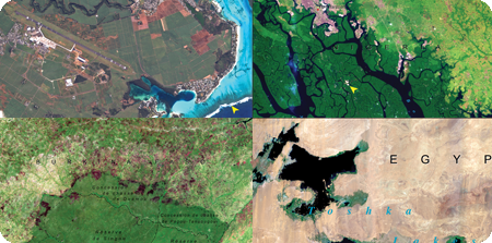
GRID's archives contain numerous high quality data sets at various scales (global, continental, national and subnational) on a variety of environment related themes. The data are provided free of charge to users around the world.
- Assistance in finding environmental and resource data
If GRID does not hold a copy of the data a user needs, GRID can try to locate it by consulting its network of collaborating institutions throughout the world. GRID-Sioux Falls is uniquely positioned at the EROS Data Center to assist users looking for terrestrial remotely sensed data for sustainable development applications.
- Data set development
GRID can respond to user needs by catalyzing and brokering the development of core data sets—for example, land cover, topography, watershed, demographics needed for environmental assessment and sustainable development planning and strategy formulation. Centralized data set development helps client agencies avoid duplication of effort.
- Assistance in metadata, geospatial data clearinghouse implementation and training
GRID can provide technical advice in the design and development of metadata, clearinghouse mechanisms to meet users current and future needs.
- Information dissemination on the information superhighway
GRID can assist users in establishing Information Servers on the World Wide Web (WWW). Specialized software can be developed and staged to provide an interactive mapping system with Internet Map Servers.
- Technology assessment
GRID stays abreast of the latest developments in science and technology of Geographic Information System (GIS), Remote Sensing, WWW and related fields and provides up-to-date information to users worldwide. A comprehensive survey of GIS and Image Processing (IP) software is performed biannually and distributed widely.
- Methodology assessment and applications
GRID is actively involved in the assessment of new methodologies that facilitate the integration of remotely sensed and other data along with and GIS technologies in applications relevant to developing countries to address sustainable development issues.
- Education and training for developing country scientists and senior officials
GRID can provide opportunities for foreign nationals to receive hands on training and experience working with state-of-the-art computers and software systems leading to national capacity building.
- Assistance in formulating projects, writing proposals and finding donors/sponsors
GRID can assist in designing projects, writing proposals and finding support for implementation of sustainable development projects that involve elements of information technologies.
Download
Regional Activities and Outputs (rtf 28k)