Thematic Focus: Resource Efficiency, Ecosystem Management, and Climate Change
Athabasca Oil Sands, Require Massive Investments and Energy and Produce Massive Amounts of Oil and CO2 Alberta, Canada
Why is this issue important?
The Athabasca Oil Sands region of Alberta, Canada forms the second-largest deposit of recoverable oil in the world after Saudi Arabia (Whitfield and others 2010).
The energy and environmental costs of extracting oil from oil sands have made their development very controversial. The oil sands industry burns about 22.5 million m3 of
natural gas daily to extract bitumen (Tenenbaum 2009). This burning is the main source of the over 8 000 tonnes of CO2 per year emitted by the oil sands industry and
accounts for much of Canada's growing CO2 emissions (Humphries 2008). In addition, the oil sands mines release a significant amount of SO2 and other atmospheric pollutants
(Williams 2010). Water is used in oil sands extraction to help separate the bitumen from the oil sands. The industry already diverts around 150 million m3 of water from
the Athabasca River and the Canadian government has approved diversions of more than twice that volume, raising concerns about inadequate flow (Humphries 2008). Waste-water
disposal from the production process goes into large tailing ponds and poses a threat to groundwater and surface water quality, wildlife and soils if leakage occurs (Humphries 2008).
Hotspot Image Viewer: 1989 and 2009
LEFT IMAGE
RIGHT IMAGE
Instructions
Compare different satellite images for this Hotspot by selecting different "Left" and "Right" images.
Use the slider located in the middle of the images to change the viewing area for each image.
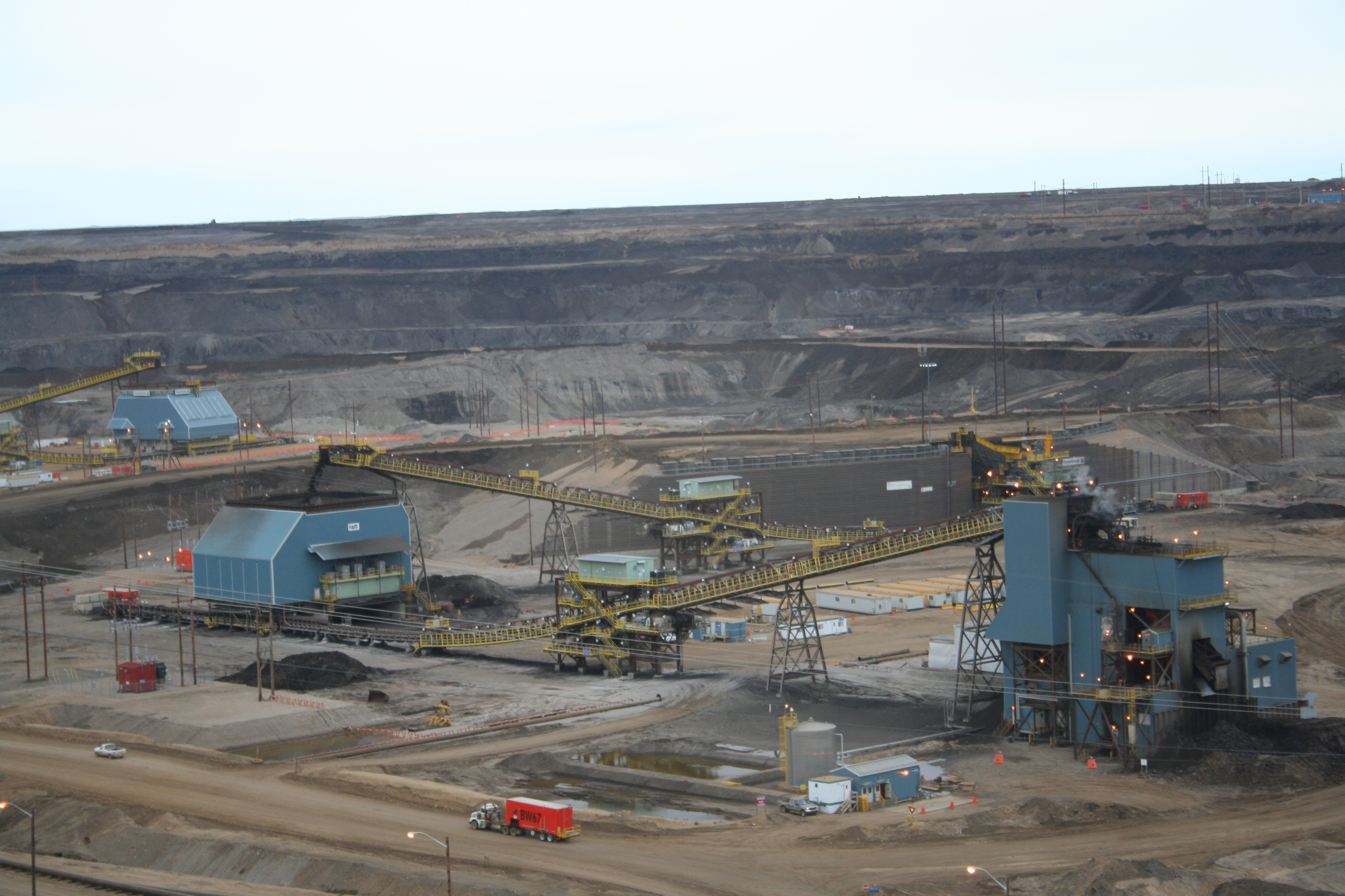
While commercial production began around Fort McMurray, Alberta in 1967, the cost of recovering the bitumen from the oil-sands deposits was expensive and the oil
was of low quality (Williams 2010). Bitumen is very heavy, low-quality oil, which is too viscous to pump from the ground. It makes up only 3 to 18 per cent of the
oil sands formations, which must be strip-mined (Williams 2010). The bitumen is then extracted using hot water and further refined to make conventional petroleum
products. As prices for crude oil rise, more of the roughly 140 000 km2 of oil-sands deposits become cost effective to mine. Oil sands production was approaching
half of all Canadian oil production in 2008 (Humphries 2008). Ninety-nine per cent of Canada's oil exports go to the United States.
Figure 3: The area and thickness of bitumen deposits lying under the Canadian boreal forest are overlain with the leases granted to several international oil developers.
Leases already cover most of the viable deposits.
In September of 2010 Canada's Environment Minister appointed a panel of leading scientists chaired by former UNEP executive director Liz Dowdeswell. They were
asked to evaluate the state of environmental monitoring in the Athabasca region. Their report found that while there were many monitoring programs and considerable
academic research that there was "no evidence of science leadership to ensure that monitoring and research activities" were coordinated and integrated (EC 2010).
What are the findings and implications?
Rising oil prices and increasing interest in finding energy sources closer to home for the world's largest oil consumer, the United States,
have led to enormous investments in the Athabasca Oil Sands an estimated US$40 billion in 2010 alone (CAPP n.d., Humphries 2008). The 1989 satellite image
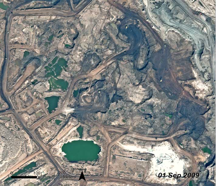
shows the footprint of oil sands mining in the Fort McMurray area just as the Canadian Government was beginning to encourage the industry's expansion. The bright
areas cut into the boreal forest and muskeg wetlands are mining pits, tailings ponds, production facilities and roads. The 2009 image shows the
dramatic growth in active operations spanning over 55 km from north-to-south.
IME. (2010). Israels Second National Communication on Climate Change submitted under the United Nations Framework Convention on Climate Change. Ed. Moshe Yanai Axelrod.
Israel Ministry of Environmental Protection 2010, Jerusalem.
Ne'eman, G. (1997). Regeneration of Natural Pine Forest - Review of Work Done After the 1989 Fire in Mount Carmel, Israel. International Journal of Wildland Fire 7(4):295-306.
Pausas, J. (1999). Response of plant functional types to changes in the fire regime in Mediterranean ecosystems: A simulation approach. Journal of Vegetation Science 10:717-722.
UFZ. (2010). Hemholtz Centre for Environmental Research, Press release: Scientists: The fire in Israel is a typical example of climate change effects in the Mediterranean.
Accessed online on December 16, 2010 at http://www.ufz.de/index.php?en=20837
Wittenberg, L., Malkinson, D., Beeri, O., Halutzy, A., Tesler, N. (2007). Spatial and temporal patterns of vegetation recovery following sequences of forest fires in a Mediterranean landscape,
Mt. Carmel Israel. Catena 71:76-83